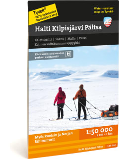
Calazo Halti Kilpisjärvi Pältsa fell map 1:50,000
Price
Price of the product when purchased separately:
17,90 €
Shipping costs starting from
3,90€

Our wonderful large waterfalls are located in the Käsivarre wilderness area. The Kalotti route connecting Pohjola leads west from Kilpisjärvi to Pältsa and Parase and northeast to Halti, which can be reached by a shorter route from the north. Saanatunturi and Malla nature park are suitable for day hikers. The border crossings of the three kingdoms can also be reached by water bus.
Printed on both sides of the maps, so one map can fit a huge area. The areas are delimited in such a way that you usually only need one map on your hike. Thanks to the clever magazine distribution, the map is also suitable for many day trips.
Routes, huts and other camping services as well as the region's tourism services are marked on the maps. The steep slopes of fells and large hills are described with slope shading, which makes it easier to read the map.
The maps are printed on the excellent Tyvek® material, which is water-resistant and tear-resistant. So you don't have to protect your map from the rain and your map doesn't tear during use. The manufacturer guarantees that the material will last 20,000 folding times.
- Size: 70 x 100 cm
- See map coverage
- Scale of the Map: 1:50 000
- EAN: 9789186773458
- SKU: 101716901
- Vendor material number: 9789186773458
Payment Methods: