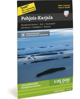
Calazo North Karelia hiking map 1:25,000
Price
Price of the product when purchased separately:
17,90 €
Shipping costs starting from
3,90€

The revamped Herajärvi tour is 60 kilometers along the dangers of Karelia and the banks of Pielinen in the national landscape of Koli. The reverse side of the waterproof map includes Patvinsuo and Petkeljärvi national parks and the Ruunaa camping area.
Printed on both sides of the maps, so one map can fit a huge area. The areas are delimited in such a way that you usually only need one map on your hike. Thanks to the clever magazine distribution, the map is also suitable for many day trips.
Routes, huts and other camping services as well as the region's tourism services are marked on the maps. The steep slopes of fells and large hills are described with slope shading, which makes it easier to read the map.
The maps are printed on the excellent Tyvek® material, which is water-resistant and tear-resistant. So you don't have to protect your map from the rain and your map doesn't tear during use. The manufacturer guarantees that the material will last 20,000 folding times.
- Size: 70 x 100
- See map coverage
- Scale of the Map: 1:25 000
- EAN: 9789186773502
- SKU: 101716895
- Vendor material number: 9789186773502
Payment Methods: