Calazo Repovesi Mäntyharju hiking map 1:25,000 +1:50,000
Price
Price of the product when purchased separately:
17,50 €
Shipping costs starting from
3,90€

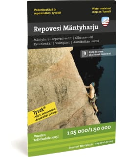
Mäntyharju's award-winning hiking, mountain biking and canoeing routes lead to the heart of Repovede National Park, where the popular Ketunlenkki and the challenging Kaakkuri tour run. Olhavanvuori's rock walls are the leading climbing destination in our country. The map also includes Vuohijärvi with its nature houses.
Printed on both sides of the maps, so one map can fit a huge area. The areas are delimited in such a way that you usually only need one map on your hike. Thanks to the clever magazine distribution, the map is also suitable for many day trips.
Routes, huts and other camping services as well as the region's tourism services are marked on the maps. The steep slopes of fells and large hills are described with slope shading, which makes it easier to read the map.
The maps are printed on the excellent Tyvek® material, which is water-resistant and tear-resistant. So you don't have to protect your map from the rain and your map doesn't tear during use. The manufacturer guarantees that the material will last 20,000 folding times.
• Size: 50 x 70 cm
- Scale of the Map: 1:50 000, 1:25 000
- EAN: 9789189079021
- SKU: 101716906
- Vendor material number: 9789189079021
Payment Methods: