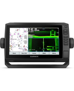
Garmin Echomap UHD 92SV chart plotter
Shipping costs starting from
4,90€

The 9-inch ECHOMAP UHD series chartplotter features a basic world map and is compatible with BlueChart g3 and g3 Vision charts with Navionics data and includes Quickdraw Contours charting software. The ECHOMAP UHD “sv” combination device has a 9-inch touch screen, which also has buttons, and is packaged with a sensor for high-wide CHIRP, Ultra High-Definition ClearVü and SideVü scanning sonar. The model supports the Panoptix LiveScope™ system. The model has Wi-Fi® connectivity that allows you to pair the free ActiveCaptain® app to use the OneChart™ service (purchase and download new charts, smart notifications, software updates, Garmin QuickDraw™ community information, etc.). The device also has a stand with quick release and support for NMEA® 2000 and NMEA 0183 networks. ECHOMAP UHD is compatible with the Force™ bow motor. The engine can therefore be controlled and operated from the chart plotter screen. Activities include e.g. creation of waypoints, following the track.
ECHO SENSOR PACKAGE
By choosing the Transducer Package, you can add a GT54 Transducer for high precision scanning ClearVü and SideVü sonar. With them, you can see under and around the boat crystal clear. In addition, you get Garmin's traditional high and wide frequency CHIRP sonar, which distinguishes objects incredibly clearly.
SOUND SUPPORT
The chartplotter supports a wide range of Garmin transducers (sold separately), such as the scanning Panoptix LiveScope™ sonar system, which allows you to see the boat's surroundings in real time.
SEA CHARTS AND OTHER MAPS
You get access to uniquely comprehensive and detailed map information, because the device supports optional BlueChart® g3 Vision coastal maps with integrated Garmin and Navionics® content.
QUICKDRAW CONTOURS
Create your own fishing charts right on the screen with curves every 0.3 meters (1 foot). You can keep the data yourself or share it with the QuickDraw™ community on Garmin Connect™.
NMEA 2000® AND NMEA 0183 NETWORKS
Connect to things like autopilots, digital connections, weather services, FUSION-Link™ audio systems, media files, VHF radio and AIS equipment on the same screen.
ACTIVECAPTAIN® APPLICATION
Connect to the free, comprehensive mobile app via Wi-Fi® to access things like OneChart™, smart notifications, software updates and Garmin QuickDraw community information.
FORCE™ BOW ENGINE SUPPORT
Control the most powerful bow motor on the market, create routes to waypoints, follow tracks and much more directly on the chart plotter screen.
Technical information:
General
Dimensions: 28.2 x 16.4 x 6.0 cm
Screen size, WxH: 19.9 x 11.3 cm; diagonal 22.9 cm (9.0 inches)
Screen resolution, WxH: 400 x 800 pixels
Screen type: WVGA screen
Weight: 1.0 kg
Water rating: IPX7
Power consumption: 18 W
Antenna: Internal or external NMEA 2000 network
Mounting options: Mounting or embedding
Receiver: 5 Hz
Transmit power: 500 W (RMS) / 4000 W (peak to peak)
Maps and memory
Preloaded maps: Global base map
Supports memory cards: 1 microSD™ card; size up to 32GB
Waypoints 5,000
Track log: 50,000 waypoints, 50 recorded tracks
Routes: 100
Transducer included
ECHOMAP UHD 92sv and global base map
GT54UHD-TM echo transducer
Charging/data cable
Tilt/rotate stand with quick-attach dock
Recessed installation
Protective cover
Hardware
Documentation
- Warranty: 2 vuotta
- EAN: 753759241629
- SKU: 102341354
- Vendor material number: 010-02341-01
Payment Methods: